
Research
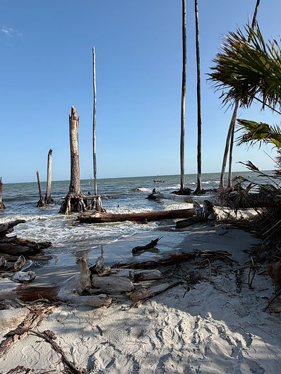
Understanding Changing Coasts
I study beaches and dunes—how wind moves sand, how coasts respond to storms and flooding, how people shape these dynamic landscapes, and what the science can teach us about living with a changing coast.
My research is grounded in the field. I combine observations and experiments with new ways of measuring coastal processes to better understand how beaches and dunes change over time.
At the heart of my work is a simple goal: to better understand how coasts work so we can make better decisions about the places we value.
About WINDlab
I founded the Wind-Induced Nearshore Dynamics Laboratory (WINDlab) as a home for research focused on beaches, dunes, and the processes that shape them. WINDlab is rooted in field science—measuring wind, sand movement, storms, flooding, and coastal change where they actually happen. Over the years, it has also become a place for collaboration, experimentation, and mentoring, bringing together students, scientists, and coastal partners to better understand how beaches work and why that knowledge matters.

What I Study
Storms and Coastal Change

What happens to a beach when the water rises?
What happens after it leaves?
Storms, hurricanes, and extreme tides can reshape beaches and dunes in hours. I study how coastal systems respond to these events, how they recover, and why some places respond differently than others. Understanding both response and recovery helps us better prepare for changing coastal conditions.
People and Beaches

We don't just live by the beaches.
We change them.
Beach nourishment, sand fencing, vegetation, and other management decisions shape the way beaches and dunes evolve. I study how these interventions affect coastal systems—and what those changes mean for beach resilience and management.
Wind and Sand

How does wind build a dune one grain
of sand at a time?
Wind-blown sand is at the heart of much of my research. I study how wind moves sand across beaches and in and out of dunes, why field observations don’t always match our models, and how better measurements can improve our understanding of these dynamic systems.
Measuring and Mapping

How do we measure a landscape that never stands still?
Understanding coastal change starts with capturing it. I use field instruments, cameras, remote sensing, and other technologies to measure processes and map change—from individual grains of moving sand to beaches and coastlines viewed from above.
Science in Practice

Research that reaches beyond the beach.
Coastal science matters most when what we learn reaches the people who live with, manage, and care about our coasts. My work connects research, mentoring, science communication, and coastal stewardship—turning what we learn about changing beaches into knowledge people can understand and use.